Bikepacking from Eugene to Sun River

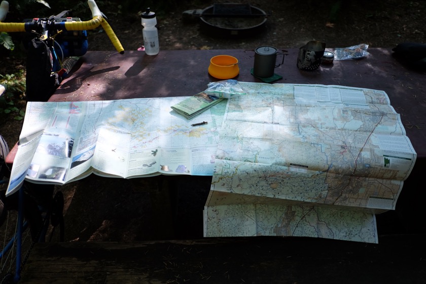
Maps played a much more critical role on this bike tour.

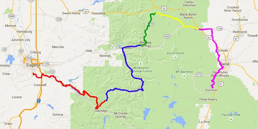
A few days ago I completed my second bike trip of the summer, a five-day, 230 mile, mostly off-road journey from Eugene to Sun River, Oregon. Instead of riding alone, as I had on my previous trip, I planned and rode this trip with Rachael's cousin Ryan, a cyclist from Minneapolis, Minnesota. I was definitely the greenhorn between the two of us, but what I lacked in physical fitness and experience Ryan made up for with good nature and plenty of patience.

Whereas my first trip around Oregon contained no major mishaps (short of being caught in the rain), this one had plenty. We ran out of water and into poison oak, spent hours pushing and carrying our bikes through unrideable trails, encountered three bears, suffered a major mechanical failure, and finished with plenty of scrapes, cuts, and sores. Key word there being finished, because I seriously wondered at several points whether I'd be able to.

The route we took from Eugene to Sun River included a trip down around Oakridge, the Aufderheide Highway, the McKenzie River Trail, the Santiam Wagon Trail, and the Deschutes River Trail.

Over the next few days I'll be posting a short blurb (transcribed from the journal I kept along the way) about each leg of our trip with a photo or two, followed by a trip report with information for other people who might want to do something similar. I couldn't find any information online about others who've taken the same route, so maybe my report will prove helpful to someone else.

This post is part of a series on my bikepacking trip from Eugene to Sun River. You can find my other posts here.

Trip Report: An 800 Mile Bicycle Tour Around Oregon

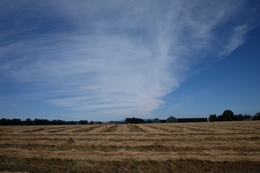
Fields in the process of being harvested, a common sight in the Willamette Valley.

In July 2015 I took an 800 mile bicycle trip around Oregon. This trip report is meant to serve as a guide for other people interested in doing something similar.

Where I Went

One of the main objectives of my trip was seeing friends and family scattered around the state, so the route I took was essentially a game of connect the dots. Once I knew where I was going, I tried to find the most peaceful roads in between. These often ended up being Oregon Scenic Bikeways - I rode on five in all: Willamette Valley, McKenzie Pass, Twin Bridges, Old West, and Blue Mountain. I took no freeways, but my route did include a lot of highways. Thankfully most of them were mostly empty. Here's a map and a day by day breakdown (minus rest days) of my route:
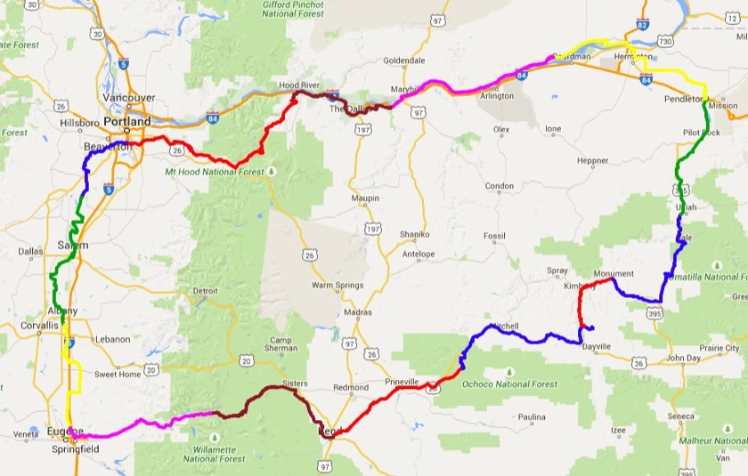
Here's the route I took. I started in Portland and rode counterclockwise. The different colors correspond to different days.

(Click on the day number for the blog post corresponding to that day, and click on the route for a map. Note that the day numbers on this post don't match up with the day numbers on the individual blog posts because I wrote posts for the rest days, too.)

Day One

Route: Portland to St. Paul
Distance: 32.8 miles
Elevation Gain: 1,671 feet
Traffic: Medium (Newberg to St. Paul was a little busy)
Food and Water: Short enough that it's not necessary, but there are stores and restaurants in Newberg.
Notes: It's possible to leave Portland on the Fanno Creak Trail. After that it's lots of farm roads, some empty and some crowded.

Day Two

Route: St. Paul to Albany
Distance: 61.2 miles
Elevation Gain: 1,210 feet
Traffic: Low (though more traffic in and around Albany and Salem)
Food and Water: Lots of options in Salem
Notes: The route goes right by the Oregon Capitol. It's worth a stop.

Day Three

Route: Albany to Eugene
Distance: 45.1 miles
Elevation Gain: 974 feet
Traffic: Low
Food and Water: Brownsville is big enough to find food and water
Notes: When I rode this leg I had an incredible tailwind. Maybe you'll be as lucky. I stayed at Armitage County Park in North Eugene on the edge of the McKenzie.

Day Four

Route: Eugene to Paradise
Distance: 57.4 miles
Elevation Gain: 1,987 feet
Traffic: High
Food and Water: Lots of little stores along the highway.
Notes: Several options for lodging around here, including at Belknap Hot Springs a little further up the road. Belknap has food and wifi, but I was happy that I slept at Paradise because it was cheaper and prettier.

Day Five

Route: Paradise to Bend
Distance: 66 miles
Elevation Gain: 5,264 feet
Traffic: Low (though Highway 20 from Sisters to Bend was really busy)
Food and Water: Water at Cold Spring Campground and food in Sisters.
Notes: I thought this day would be really, really hard, but it ended up being just pretty hard. The ride up McKenzie Pass was one of the most beautiful roads I've ever ridden.

Day Six

Route: Bend to Ochoco
Distance: 54.8 miles
Elevation Gain: 1,905 feet
Traffic: Medium
Food and Water: Prineville
Notes: I got rained on, but I think that's uncommon for this area. No cell service outside of Prineville. I stayed at the Ochoco Forest Campground which has water.

Day Seven

Route: Ochoco to Dick Creek
Distance: 69.8 miles
Elevation Gain: 5,870 feet
Traffic: Medium
Food and Water: The Sidewalk Cafe in Mitchell is run by a woman from Portland (my people!) and has food and wifi.
Notes: I stayed at Land's Inn (a so-called "pilot ranch"), which was great. The only problem is that you have to ride 2,000 feet up a dirt road to get there.

Day Eight

Route: Dick Creek to Monument
Distance: 27.5 miles
Elevation Gain: 956 feet
Traffic: Low (I was passed by two cars the whole day)
Food and Water: There's a little store in Kimberly.
Notes: This was a kind of rest day, hence the shorter mileage.

Day Nine

Route: Monument to Ukiah-Dale
Distance: 61.1 miles
Elevation Gain: 5,683 feet
Traffic: Low
Food and Water: You can get breakfast (and wifi) at a grocery store and diner in Long Creek. There are also a few stores scattered along the way. I stopped at one in Dale for a beer. You can also get dinner (and wifi) in Ukiah at the Thicket.
Notes: I was only passed by a couple cars between Monument and Long Creek. I was a bit worried about traffic (particularly trucks) on Highway 395 but it ended up not being an issue at all. I ate dinner in Ukiah and then stayed at the Ukiah-Dale Campground on the banks of Camas Creek.

Day Ten

Route: Ukiah-Dale to Pendleton
Distance: 47.6 miles
Elevation Gain: 1,920 feet
Traffic: Medium
Food and Water: Pilot Rock
Notes: The ride was really pleasant as far as Pilot Rock. After that the roads are a lot busier. It's pretty cool to come out of the Blue Mountains and onto the Columbia Plateau, but at least when I was riding the transition brought some wind, too.

Day Eleven

Route: Pendleton to Crow Butte
Distance: 71.1 miles
Elevation Gain: 1,426 feet
Traffic: Medium
Food and Water: Hermiston and Umatilla
Notes: Most of the ride was pretty empty but there is a fair bit of traffic (especially semis) on Highway 14 in Washington. I stayed at Crow Butte Campground. I met a couple people on tour here, which makes sense because Highway 14 is on the Adventure Cycling Association's Lewis & Clark Route.

Day Twelve

Route: Crow Butte to Deschutes
Distance: 63.5 miles
Elevation Gain: 2,406 feet
Traffic: Medium
Food and Water: Roosevelt
Notes: There's a store and short order cafe (with wifi) in Roosevelt, Washington. They even have a guest book for cyclists to sign. The wind generally blows from the west, so you'll have a headwind if you're headed toward Portland. Camped at the Deschutes River Campground five miles west of Biggs Junction. It was full, but it was a Saturday. I doubt it fills up during the week.

Day Thirteen

Route: Deschutes to Hood River
Distance: 49 miles
Elevation Gain: 3,291 feet
Traffic: Low
Food and Water: The Dalles (and probably Mosier, but I didn't stop there)
Notes: The first third of this route is on empty farm roads (with some gravel), the second third is on a (mostly) empty highway, and the final third is on a path that's closed to cars completely. It was hot and windy, but the riding was really pleasant.

Day Fourteen

Route: Hood River to Portland
Distance: 89.3 miles
Elevation Gain: 5,790 feet
Traffic: Low
Food and Water: Welches, Gresham, and others
Notes: I was a little worried about this route since there wasn't much information on it online (and the one thing I did see listed a ridiculously erroneous 8,000+ feet of climbing) and it includes Forest Service roads (which are an excellent way to get lost) but it ended up being a really great day of riding. Most of the climbing happens early on, and then it's almost all downhill for the final 55 miles into Portland.

What I Packed

All together, my bike, gear, and food weighed about 66 pounds. I was mostly happy with the amount of stuff I packed, but some people go much lighter, and some people go much heavier.

Here's a photo of everything and then a category by category breakdown:
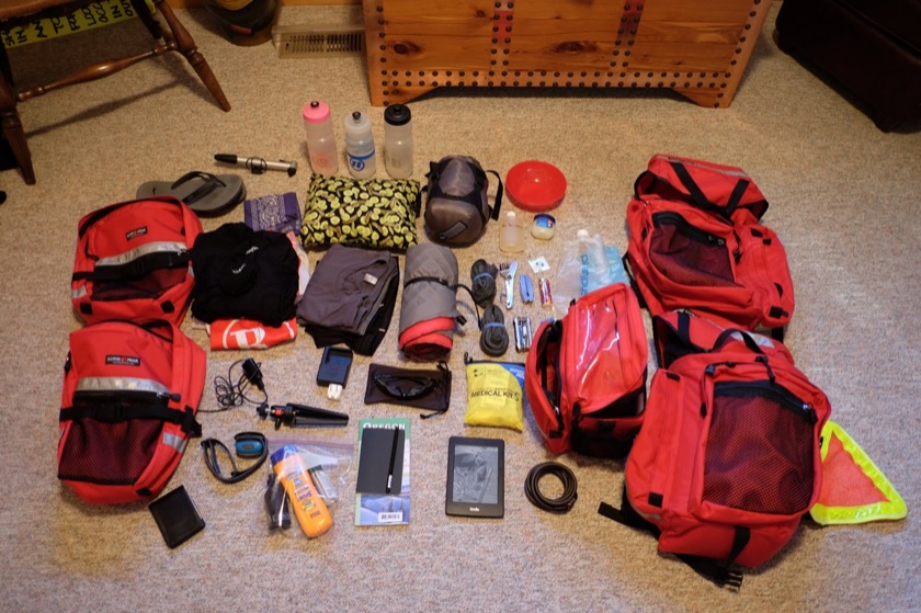
Panniers on the side, gear (minus food) in the middle.

Camping

Tent with fly: Thought about leaving the tent behind, or at least the fly, but I'm glad I didn't.
Sleeping bag: My 40° down bag left me a little chilly, but that's because I didn't bring proper long underwear.
Sleeping pad: Useful
Pillow: Bought on a JetBlue flight. A luxury, but a very light, cheap luxury. Glad I brought it.
Utensils: The only meal I prepared was peanut butter honey wraps so the only utensil I needed was a knife. I sent the fork and spoon home when I was in Bend.
Bowl: Didn't need it. Sent home.
Sunscreen: Very valuable. Used about six ounces.
DEET: Only used once but I'm glad I had it.
Pocket knife: Only used once or twice but I'm glad I had it, mostly because it had pliers and a sharp, three inch blade.
Headlamp: Only used this a couple times because I usually went to sleep before sunset, but I'm glad I brought it. Could've doubled as a bike light if I needed one.
First aid kit: Didn't use it, but prudent to have at least a small one on hand, especially in the event of a bike crash.
Vaseline: Absolutely necessary to prevent saddle sores. Bag balm and chamois butter works well too.
Soap: Two ounces of Dr. Bronner's was plenty. Used for washing up and doing laundry.
Bandanas: One of the most useful pieces of traveling kit there is. Had one for padding camera and one for bathing. When bathing, use it as a washcloth first, then rinse, wring out, and use as a towel to dry off.
Lighter: Didn't use but it weighs almost nothing and is perfect for when you need to start a forest fire by burning used toilet paper.
Fanny pack: Bought this at Fred Meyer in Newberg so I'd have a place to put my camera, phone, and wallet. The shorts I brought for wearing off the bike didn't have pockets.

Bike

Bicycle: A 2009 Surly Long Haul Trucker, mostly stock, except for clipless peddles, a Cardiff saddle, and downtube shifters. I added SKS fenders.
Panniers: Lone Peak P-500, P-099, and H-100 matched set from Wayne at The Touring Store.
Bottles (3): I carried two 24 ounce water bottles and one 16 ounce bottle. This was enough with water stops along the way, but had it been hotter I would've carried an extra 16 ounces or so.
Tail light: Helpful for visibility when riding in the rain or in the evening.
Multitool: Only used a couple times (like when I got a flat), but obviously a necessity.
Patch kit: Make sure the glue is fresh.
Tubes (2): I think two is enough.
Pump: Small, so it took a Herculean effort to get to 85 psi.
Chain link: Didn't use it, but necessary if your chain breaks.
Lock: Coiled, so not too secure, but good enough in a pinch and not too heavy. Coiled is also easier for locking to odd objects like trees and picnic tables.
Safety triangle: One of my proudest purchases, safety pinned to my rear pannier.
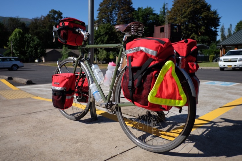
All loaded up on the way to the McKenzie Pass.

Clothing

Flip flops: My off-the-bike footwear. Not good enough for a hike, but light and disposable.
Soccer shorts: My only off-the-bike bottoms.
Underwear: Ex-Officio for off-the-bike.
Long-sleeved capilene shirt: Recommended by Gordy, ended up being a critical piece of clothing. Wore during the day, to sleep, and sometimes as an undershirt when riding on colder days. Smelled awful.
Socks (2): Probably could've gotten away with one pair.
Cycling shoes: I'm used to riding clipless, otherwise street shoes and platform pedals would've been fine.
Bib shorts (2): Glad to have a fresh pair to change into. Probably helps prevent saddle sores and infection, too.
Jersey: Only took one so that my tan lines would be uniform. Smelled terrible, but that doesn't matter when you're on the bike.
Undershirts: Could've gotten away with one.
Sunglasses: Cheap plastic pair from Performance Bike.

Toiletries

Contacts: I decided against bringing my glasses. In retrospect, it probably would've been nice to take out the contacts at the end of the day and wear glasses.
Contact solution: Small travel bottle.
Contact container: Self-explanatory.
Eye drops: Hours on the road in the sun can do a number on my eyes so I brought eye drops, but I ended up not using them.
Toothbrush: Self-explanatory.
Toothpaste: Brought a small travel-sized tube.
Floss: Whenever I eat lots of jerky I have to be extra diligent about flossing.
Razor: Used once and then sent home. Helped me to feel less like a caveman but probably not worth the weight.
Advil: Didn't use but nice to have on hand.
Steroid cream: For eczema.
Deodorant: Ended up sending this home. Not worth the weight.
Imodium: Didn't need, thank goodness.
Earplugs: Makes it much easier to sleep in crowded campgrounds.
Tweezers: Sent home, but then I got a sliver. Probably worth the weight.
Fingernail trimmers: Sent home. The scissors on my pocket knife work well enough.
Hand sanitizer: Only used a few times but nice when using campground pit toilets.
Toilet paper: Just in case.

Stuff

Map: Brought along a statewide map of Oregon thinking it'd be really romantic to have it spread out at restaurants or campgrounds, pouring over my route, but ended up sending it home because it didn't have many of the smaller roads I was riding on and my phone was much more helpful for navigating.
Fuji: My camera for the trip, an X-T1 with a wide-angle lens. Thought about bringing along a small point and shoot but I'm glad I brought my nicer camera.
Fuji charger: I didn't take a lot of pictures so only had to use this once or twice.
Nexus 5 smartphone: Thought about leaving this at home, but it ended up being incredibly useful. Phone to keep in touch with Rachael, Ride with GPS for navigating, and WordPress for blogging. Left in airplane mode most of the time to save battery.
Nexus charger: Did most of my charging at restaurants. Look for the table next to an outlet.
Kindle: I thought I'd have a lot of free time but I ended up sleeping as often as I could.
Wallet
Cash: I brought $300 and spent most of it. Handy for paying at campgrounds and small mom and pops that don't accept credit cards.

Food

I decided against bringing a stove and just figured out one meal that I could eat several times a day without getting sick of it. That meal was crunchy peanut butter and honey wrapped in a flour tortilla. No plate necessary, and the only utensil you need is a knife. For snacks, I had jerky and raisins. I carried enough of all of this three or four days and then refilled at grocery stores.

I ate at restaurants whenever I could to mix up the menu and save my food. On average, I ate one meal in a restaurant each day and made two meals myself.

Tortillas: Don Pancho ten pack, went through two.
Peanut butter: Two small chunky jars.
Honey: One bear's worth.
Jerky: Protein.
Raisins: Sugar.
Gatorade powder: I'd mix up one bottle of this a day at half the recommended strength. Tastes gross otherwise.
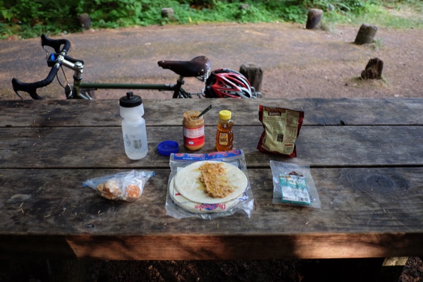
Breakfast.

How It Went

What went well

Planning: A lot of blog and forum posts I read about touring recommended figuring out your route and lodging along the way. That may work for some people, but I was happy to have planned those out before I left. Had I not planned ahead I might have missed the better roads, gotten lost, or worse. On the other hand, I probably missed out on other things which might've been better than what I'd planned. But I think this mostly about personality and personal preference. I'm a planner in my day to day life and my tour was a natural extension of that.

Routing: I started with shorter, easier days through the Willamette Valley before tackling the Cascades and the Blue Mountains. If, on the other hand, I'd ridden clockwise, starting by riding east through the Gorge, I don't think I would've been in good enough shape (though I would've benefitted from a tailwind).

Rest days: The point of this trip was visiting friends and family, so I spent at least a full day hanging out with each of them. These rest days also kept my legs fresh through a tour I was physically unprepared for.

Food: Even as I write this, having eaten dozens of peanut butter honey tortillas, I could totally go for another one. The more of them I eat, the more I'm convinced that they're the perfect traveling light meal. They provide protein, carbohydrates, fat, and salt, plus they're delicious and easy to prepare. What else could you ask for?

Visiting: The original objective of my trip was to visit friends and family scattered around Oregon. I would've organized my trip differently if I were riding just to ride, but I'm really glad I had great people to see along the way.

Pictures: I almost brought a point and shoot camera to save on weight, but the extra weight of my nicer camera was well worth it. Taking pictures wasn't a major objective for the trip, but I'm glad I had the gear to take good ones.

Smartphone: As I wrote above, this was almost a low-tech trip, but bringing my phone was one of the best decisions I made.

Health: I was pretty diligent about preventing saddle sores (with Vaseline) and sunburns (by riding early in the day and wearing sunscreen).

Lock: I almost didn't bring a lock, but I ended up using it every day. If someone really wanted to steal my bike they could've (I only had a coil lock).

What didn't go well

Weather: I wasn't prepared for the rain and I got rained on. Next time I think I'll bring bag covers for my panniers and Ziploc bags for my electronics. I wouldn't bring a full set of rain gear because I don't mind riding in the rain (your body will dry off eventually, especially when exercising). I just want my sleeping bag and other personal effects to stay dry.

Clothing: It got colder than I expected at night when I was camping in the mountains, so I should've brought long underwear to sleep in.

Next time

One of my biggest worries about this first tour was that I'd bitten off more than I could chew and that by the time I finished it I'd never want to ride a bike again. But what I found was a completely new reason to. Waking up in the morning and knowing that I had to travel 70 miles before sundown made me feel like an ancient explorer or someone on the Oregon Trail. I'm looking forward to being able to do it again.

The whole point of this post is to share the things I learned from my trip. If there's something you'd like to know about that I didn't cover, please leave a question below and I'll do my best to answer it.
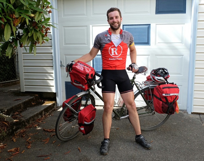
Me at the end of my last day.

Aroundegon Day Twenty: Hood River to Portland

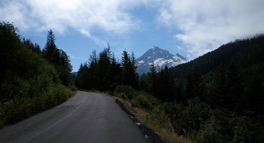
Looking back at Mount Hood from Lolo Pass.

Distance: 89 miles (of 819 total)
Elevation Gain: 5,800 feet (of 39,700 total)
Pounds of Food Consumed: 7

When I first planned this trip in the spring, riding 89 miles and climbing 5,800 feet over a gravel mountain pass seemed way over my head. It'd been about 13 years since I'd ridden my bike more than 50 miles, let alone the climbing, and the gravel, and being on a bike that weighed 65 pounds. All of those factors were still heavy on my mind when Mike (who was accompanying me for the first 30 miles) and I began our journey at 6:30 on Tuesday morning.

It was cool with wind out of the west, which meant I'd be riding with a headwind for part or all of the day. But I was in good spirits because the sun was shining, I had company, and we'd gotten an early start to the day.

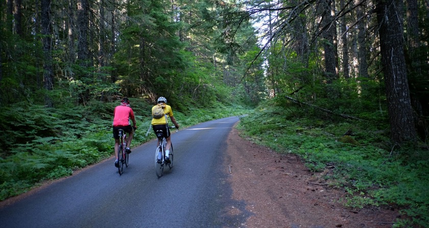
Mike and I met a friend of his named Jeff in Dee, and after introductions the three of us rode up toward Lost Lake. The road eventually turned from two lanes to one and alternated between forested, overgrown, and pretty, and clear-cut, exposed, and windy. High voltage power lines led us along with their audible hum, and the road went up, and up.

Mike and his friend Jeff accompanied me for the first part of the ride.

When the road turned to gravel Mike, Jeff, and I said our goodbyes. I continued on, optimistic at first because of the fine, well-packed gravel, and then less so when I started to suspect that I'd taken a wrong turn. A quick map check showed that I had somehow gotten off of the main road, but as long as I continued in the direction I was going I'd be fine.

I returned to a paved road at the summit and was treated to an intimate view of Hood, much closer than I'm used to seeing it from Portland. The descent down toward Welches was windy and quite cold, but putting on my long sleeved polypro shirt helped. I'd read that the paved section of the road (called Lolo Pass Road on the southwest side of the pass) was in poor condition, but they appear to have done a lot of work on it. I found it in great condition with the exception of a big pothole halfway down.

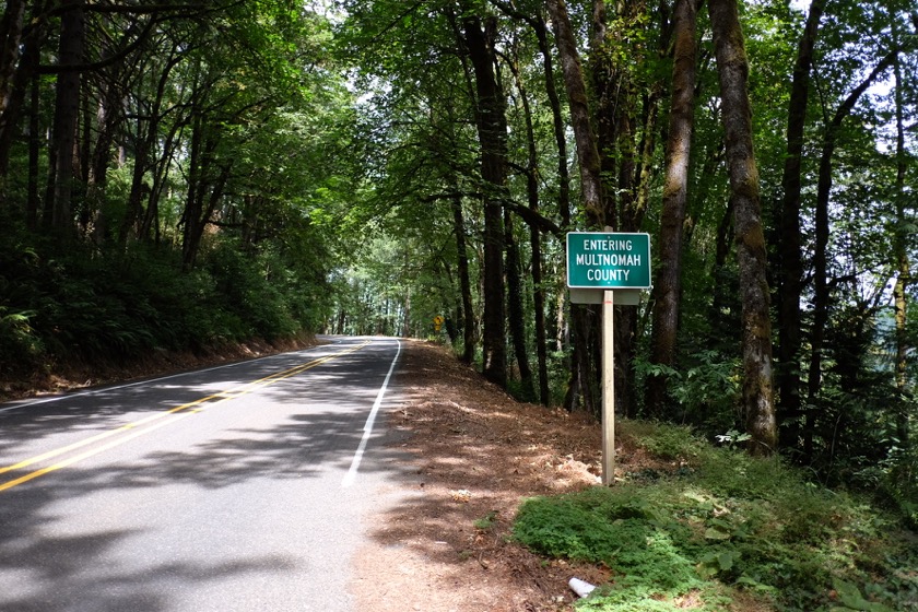
Back in the county where it all began.

From the bottom of Lolo Pass Road I continued back toward Portland on 40 miles of beautiful, uncrowded, mostly downhill roads. Gordy had agreed to join me for the last 20 miles, so we met outside of Sandy and talked about the past few weeks as we rode in on the Springwater Corridor, which is free of cars and hills. The final section of the ride - a short and steep climb up the Riverview Cemetery - was a kind of finish line for me, and even though I'd made a point of taking the tour slowly and easily, I couldn't help but race my bike up the hill, panniers and all.

Now that I've completed my bicycle tour I can't help but compare mine to others I've read about online. Other people have ridden much further, in worse weather and on rougher roads, and in scarier areas. They've packed less, camped more, gathered better stories, and taken better pictures.

Still, I can't help but feel proud of myself. The goal - riding 800 miles across Oregon with my home on the back of my bike - seemed almost insurmountable. And as I wrote before I left, that was the whole point.

This post is part of a series on my bicycle tour around Oregon. You can find my other posts here.

Aroundegon Day Nineteen: Catching Up in Hood River

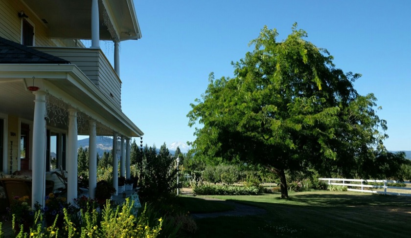
Rachael and I were married under this tree exactly two years ago today.

No time on the bike today, but I did eat a delicious breakfast (blueberry pancakes) and a delicious dinner (pork sausage, plus kohlrabi, tomatoes, cucumbers, and more bounty from Leanne’s garden). In between I visited the Hood River County Historical Museum (where Leanne volunteers), wrote a few blog posts, and ran some errands with Mike.

It seemed that wherever we went Mike knew someone who he wanted to introduce me to. "This is my friend Alex and he’s riding his bike across Oregon!" I met the post office clerk, the gym receptionist, and the butcher at their grocery store. It was a refreshing departure from the increasingly anonymous culture many of us have become accustomed to.

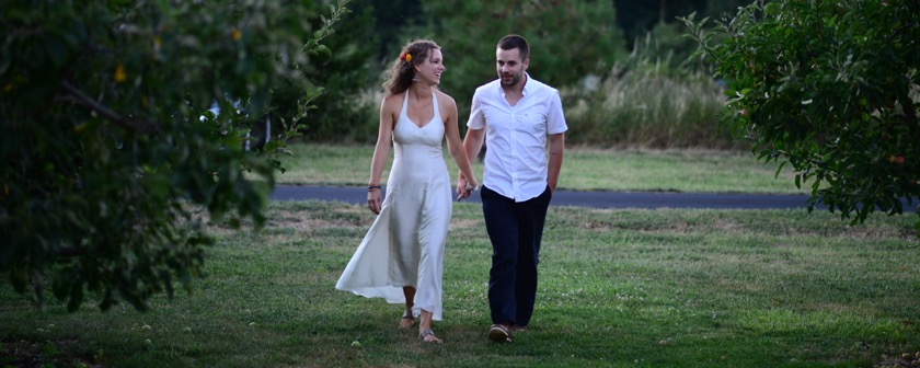
When Rachael left Qatar a month ago to lead her study abroad trip, I knew that one of the downsides would be that we'd be apart on our anniversary. What I didn't know was that I'd end up at the exact location where we'd been married on the exact same day two years ago. So even though today was to be my final rest day before returning to Portland and completing my trip, it was also an opportunity to reflect on the last two wonderful years that I've spent with Rachael. Aww!

Rachael and me walking in Mike and Leanne's orchard  on our wedding day in 2013.

This post is part of a series on my bicycle tour around Oregon. You can find my other posts here.

Aroundegon Day Eighteen: Deschutes to Hood River

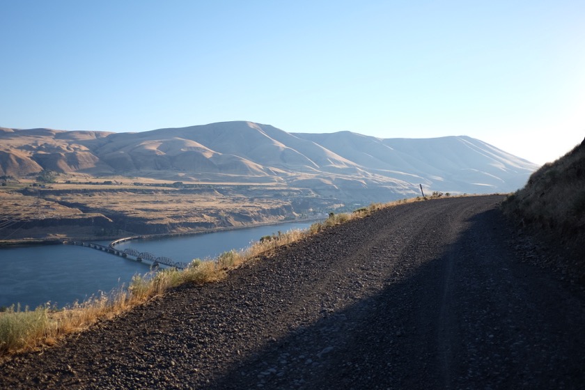
Gravel road, no guardrail, and 700 feet down to the Columbia. Beautiful way to begin the day.

Distance: 49 miles (of 720 total)
Elevation Gain: 3,300 feet (of 33,900 total)
Touring Cyclists Spotted So Far: 10

For the first couple weeks of my trip my nemesis was the mountains, especially since my bike and gear weigh around 65 pounds (and significantly more when they're wet). But now that I've gotten further into the Gorge and closer to Portland, I'm spending more and more energy fighting the wind.

Given the choice between slogging up a hill and fighting a headwind on the flats, I'd take the former without even having to think about it. Going uphill on a bike (assuming you ride back down) is like putting away money for a rainy day - eventually you'll get to spend it. Fighting a headwind, on the other hand, is like paying taxes. You may get something out of it, but you're never going to see that money again. The effect of wind is compounded by my panniers, which stick out and catch the wind like the sails on a ship going the wrong direction.

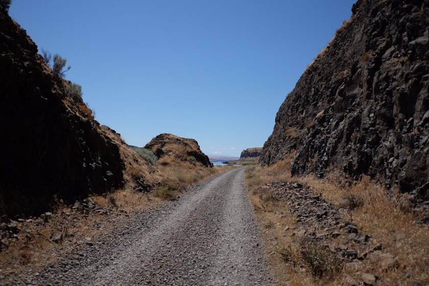
So it was for my ride from the mouth of the Deschutes on to Hood River. Ten miles an hour gusting to twenty in the afternoon, and hot. But I'm not complaining. It was a beautiful ride on roads with barely any traffic, and even closed to traffic completely in parts.

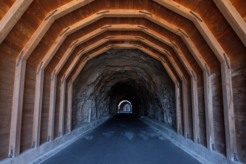
This path, which follows the old Columbia River Highway, connects Mosier to Hood River. It's totally closed to cars.

When I arrived at the home of my fantastic hosts Mike and Leanne in Hood River, I laid down in their hammock in the shade and slept for several hours. A wood plank salmon dinner followed, then ice cream with berries and cherries, and a lot of good talk about living overseas, an experience we share. After they turned in for the night I took a dip in their hot tub and looked out at the bright stars and the Milky Way, perfectly visible thanks to a lack of clouds and a nearly new moon.

I'd originally planned to go directly onto Portland on Monday, but in keeping with the trend I've been cultivating on this trip I've decided to spend an extra day in Hood River. With hosts as wonderful as the ones I have here, it'd be impossible not to.

This post is part of a series on my bicycle tour around Oregon. You can find my other posts here.

Aroundegon Day Seventeen: Crow Butte to Deschutes

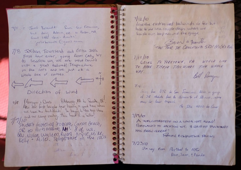
A small restaurant in Roosevelt, Washington had a guest book for cyclists on tour to sign. Pretty cool, except that most of them were headed east and enjoying a strong westerly tailwind.

Distance: 64 miles (of 671 total)
Elevation Gain: 2,400 feet (of 30,600 total)
Prevailing Wind: Westerly
High Temperature: 99 degrees

Expecting wind and heat, I got on the road early today. I'd been without cell service the night before but once I was close to the highway it came back so I called Rachael to catch up on each other's progress. She's still in Peru so whenever both of us are able to talk we take advantage of it.

Today was a pretty boring day with one goal: get off of Highway 14. The road quality was degrading and the traffic increasing. I was ready to be on side roads again.

The only food to speak of was at a convenience store and short order cafe in Roosevelt, Washington. There wasn't much to it, but it was a welcome respite after being on the road all morning. I signed their guestbook (see above) and even ran into the two cyclists I'd camped next to the night before.

I don't have a cycling computer with me so I measure my distances by mile markers when I have them, and by guessing when I don't. I was counting down to marker 108, when I'd turn off onto the "Old Maryhill Highway" and rejoin the main road at the bridge into Biggs Junction.

Google thought this gravel road with golf ball sized rocks would make a nice detour off of Highway 14. Nope.

Unfortunately, what Google calls an "old highway" I'd call a stream bed with tire tracks. It took me the better part of an hour to bump over its four or so miles, wishing the whole time that I'd stayed on the main road. On the bright side it delivered me to a fruit stand in Maryhill where I sampled half a dozen peach slices and walked away with two whole ones of my own. From there it was over the Sam Hill Memorial Bridge on Highway 97 and down to the Deschutes River State Park, prominently advertised next to signs which said "No Vacancy." Damn.

When I asked a ranger if there was anywhere else I could camp, he pointed me upriver toward primitive campsites and implored me to watch out for rattlesnakes. I didn't want to have to worry about rattlesnakes, so after a brief dip in the Deschutes I walked back to the campground and asked the camp host if there were any other options. He said their was a special site reserved for "managers" where I could pitch my tent, but that it was heavily sloped and right next to the driveway. I took him up on it.

The family who was camped next to me were eager to share their beer and dinner, so I spent the rest of the evening talking with them about unions, the Israeli-Palestine conflict, and what it's like to live in the Middle East.

Tomorrow I'll take some dirt paths and side roads out to Hood River. It's supposed to be hot and windy, so I'm hoping to be on the road by 6 a.m.

This post is part of a series on my bicycle tour around Oregon. You can find my other posts here.

Aroundegon Day Sixteen: Pendleton to Crow Butte

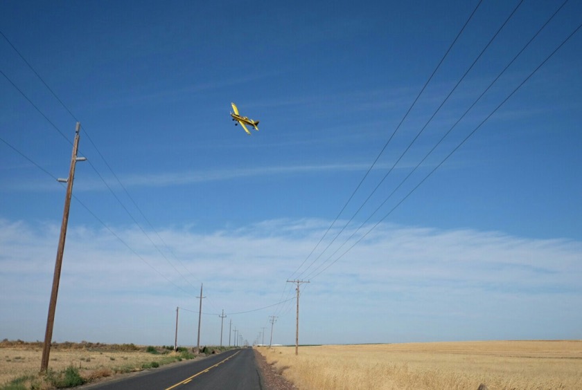
I'd never seen a crop duster in action. Pretty impressive to see them flying so close to the ground, especially over a hilly field.

Distance: 71 miles (of 607 total)
Elevation Gain: 1,300 feet (of 28,200 total)
Crop Dusters Spotted: 2
Flat Tires: 1

My aunt Lori and uncle Brit had helped me put together a route out of town so as to avoid gravel farming roads, and their advice proved very helpful. They pointed me toward a road that took me almost all the way from Pendleton to Hermiston, about 25 miles, without a single car. I did come across a couple terriers that were eager to give chase, but their short little legs were no match for my 29" wheels.

Shortly before I arrived in Hermiston my bike began to feel a little squishy in the back. Sure enough, I'd gotten a flat. Thanks, Lori! Seriously, though, the flat was actually caused by a small piece of glass that had worked its way into the tire. I'd probably been carrying it around for years.

I pulled into some shade on a side road and pulled off the rear wheel, then took off the tire. The glass was easy enough to find and remove, but when I pulled out the replacement tube I realized that it was actually the wrong size. Whoops. I'll just patch it, I thought, but it turned out that my rubber cement had dried up after years of sitting around. Double whoops.

Luckily the replacement tube was a close enough fit so I swapped it in and continued onto Hermiston. After a quick stop at a bike shop there I had the right size tubes, fresh rubber cement, and a healthy dose of gratitude that this didn't happen between Prineville and Pendleton, where I'd gone several hundred miles without seeing a bike shop.

Now on the Washington side of the Columbia, I turned my bike back to the west and began the long, 80 mile grind (to be completed tomorrow) on the less than ideal Highway 14. Thankfully the shoulders were wide, the road smooth, and the traffic relatively light. It wasn't quite like how I'd owned the road in Central and Eastern Oregon, but not too much to complain about, either.

I pulled into the campground at Crow Butte in the early afternoon, thankful to be getting off of the hot road and into some cool, grassy shade. Not long after I arrived a couple more cyclists came in, the first I'd seen in about 400 miles. Wes and Lauren are about to finish a long tour from Chicago to Astoria. Even though I'm content to travel alone, I appreciated the opportunity to trade stories with people who were experiencing a lot of the same things as me. I'm on an established cycling route now (the Lewis & Clark Trail, from Missouri to the coast) so I expect to be seeing a few more cyclists.

Tomorrow I'll be back on Highway 14 for about fifty more miles before reaching Maryhill and crossing back into Oregon. I'm excited to be continuing west, but not excited to be riding on that road. Hopefully it's not too much trouble.

This post is part of a series on my bicycle tour around Oregon. You can find my other posts here.

Aroundegon Day Fifteen: Catching Up in Pendleton

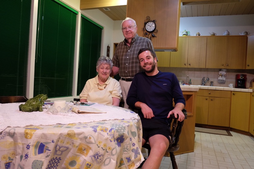
My Grandpa Bill, Grandma Nancy, and me.

Today was my last (planned) rest day, a chance to catch up with my grandparents, recover from the last few days of riding, and prepare for the final leg of my trip: a four day journey up the Columbia Gorge to Portland.

On my riding days I get up early to beat the heat and wind and to make sure I have plenty of sunlight to get to my destination, but today I slept in till 8.

I didn't accomplish much today, by design, except for skyping with Rachael, writing a blog post, and talking with my grandparents.

For dinner we went out to a (well, the) Thai restaurant in Pendleton. They wanted me to recommend some dishes, so we shared green papaya salad, massaman curry, and pad thai. Maybe next time they'll try a Thai iced tea, too.

After dinner we stopped off at my aunt and uncle's house to say hello. Lori asked me if I'd gotten any flats, which I'd been avoiding mentioning so as not to jinx myself. No flats so far, 536 miles in. But maybe now I've been jinxed!

Tomorrow I ride up into Washington to follow the Columbia River on Highway 14. Interstate 84 on the Oregon side is the more direct route, but I don't want to ride on the freeway. I'll cross back over into Oregon at Biggs Junction in a couple days.

This post is part of a series on my bicycle tour around Oregon. You can find my other posts here.

Aroundegon Day Fourteen: Ukiah to Pendleton

Just north of Battle Mountain, the forested peaks of the Blue Mountains give way to the rolling grasslands of the Columbia Basin. What a sight.

Distance: 50 miles (of 536 total)
Elevation Gain: 1,900 feet (of 26,900 total)
Elevation Loss: 3,800 feet
Owls Spotted: 2

Today was an easier day, just fifty miles mostly downhill from Ukiah to Pendleton. I'd planned on being out of the campground by 6 a.m., but it was so cold outside (for me, anyway - it was probably only in the mid-fifties) that I stayed in my sleeping bag and slept for an extra hour. Note to future self: bring long underwear.

Just like yesterday, the day began with a climb, though much smaller in comparison. The high point was Battle Mountain at 4,270 feet, followed by a thirty mile, gradual descent into Pilot Rock and Pendleton, my stopping point for today.

I can't stress enough how dramatic the transition is from the trees and peaks of the Blue Mountains to the wind and rolling hills of the Columbia Plateau. And it happens almost immediately. You come out of the trees and bam, you're in a whole new world.

Pendleton is not a new city for me. I've never lived here, but I've come here many times to visit family. Usually I come in September during Round Up, a rodeo that sees the city's population triple in size. But this time I'm just resting my legs and catching up with my grandparents, so a little less fanfare is fine by me.

Tomorrow is my last planned rest day, after which I'll point my bike into the wind and head back to Portland.

This post is part of a series on my bicycle tour around Oregon. You can find my other posts here.

Aroundegon Day Thirteen: Monument to Ukiah

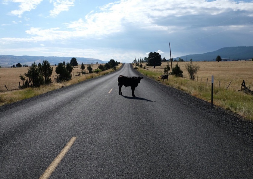
The steer and I found ourselves at a bit of an impasse.

Distance: 66 miles (of 486 total)
Elevation Gain: 5,600 feet (of 25,000 total)
Coyotes Spotted: 2
Raindrops Felt: 0

After three days of dodging thunderstorms (some days more successfully than others) I finally enjoyed a perfect ride. I started from Monument around 6:20 a.m. in an effort to do most of my riding in the cooler part of the day. Breakfast was a rolled up tortilla filled with peanut butter and honey, plus some beef jerky. The longest climb of the day came first, which is just how I like it. I made it over the top before the sun was too high in the sky, and then descended into Long Creek for a second breakfast of french toast, eggs, and bacon.

It was quite a morale boost to be so far along (climbing-wise, anyway) so early in the day, but when I looked up the weather report I found more thunderstorms in the forecast. Looking outside mirrored the report - there was a big thunderhead on the horizon but I couldn't tell which direction it was headed. Not wanting to be caught in, I hit the road again, now heading north on 395.

It only took ten minutes of watching the skies to see that the storm and I were headed in different directions. The rest of the day continued on just like that. A few clouds here and there, but nothing to worry about.

The riding was pleasant, too. The road was smooth and low on traffic, and offered many excellent views of the John Day River and the Columbia Plateau. (Maybe the Wallowas and the Blue Mountains, too, but I'm not sure.)

My body seems to be holding up well, all things considered. As soon as I start peddling my legs feel exhausted, but once I develop a good rhythm the pain goes away. I don't have any lingering injuries or soreness, which is something I'd been worried about before I started. Hopefully that trend continues.

Tonight I'm in a campground on Highway 395 (and posting this from a restaurant in Ukiah). Tomorrow I'm off to Pendleton to visit my grandparents. After that, it's just four more days on the road before I'm back in Portland.

This post is part of a series on my bicycle tour around Oregon. You can find my other posts here.