Surveying the Damage

summary image

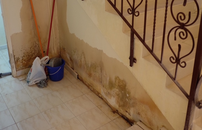
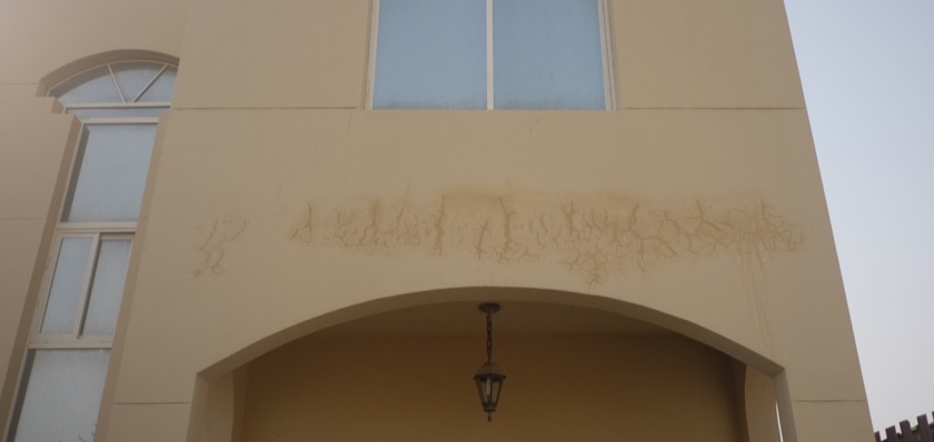
Ever since we'd received word of the water leak, I'd imagined what it'd be like to open our door for the first time and see the damage for ourselves. In reality, we didn't even need to open the door because we could see it as soon as we pulled into the driveway.

Read more →

A Flood in the Desert

summary image

I was checking my work email a few days ago when I came upon one from our HR guy that began like this: "I received a phone call from housing services concerning a water leakage in your villa."

Read more →

Gliding Into My 29th Year

summary image

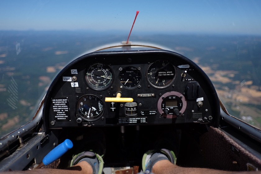
Rachael didn't tell me where we were going, but by the time I saw the gliders lined up along the side of Highway 26 at the Willamette Valley Soaring Club, I knew exactly what my birthday surprise would entail.

Read more →

Serendipity at the Bus Stop

summary image

Rachael and I were walking home from the bus stop the other night when a young man carrying two large backpacks and a suitcase asked us if we knew the way to Lewis & Clark College.

Read more →

Trip Report: Bikepacking from Eugene to Sun River, Oregon

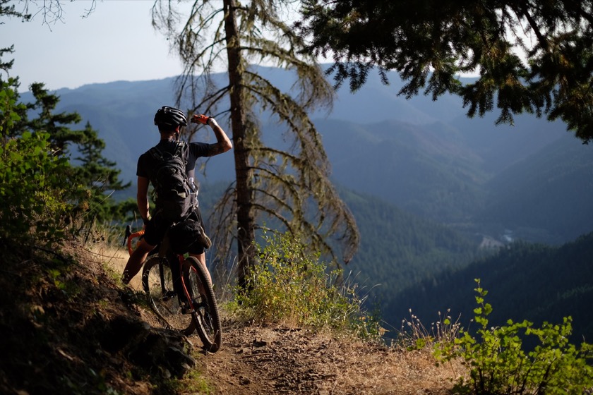
Ryan looking out at what we'd been climbing on our way to West Fir.

In August 2015 I took a 230 mile bikepacking from Eugene to Sun River, Oregon with my wife's cousin, Ryan. This trip report is meant to serve as a guide for other people interested in doing something similar.

Where We Went

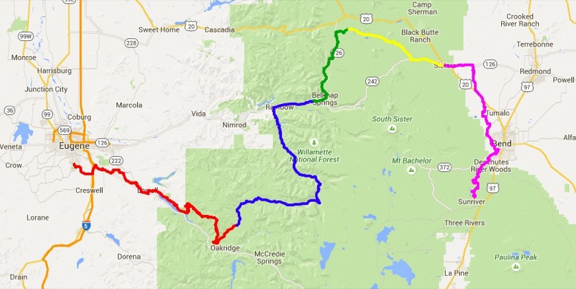
Ryan and I had about five days to plan a bikepacking trip based out of Eugene before we had to meet up with our families who were vacationing in Sun River. We originally planned on riding the Three Rivers Route and then bussing it to Central Oregon, but we decided to ride all of the way there instead. Here's a map and a day by day breakdown of our route:

The route we took from Eugene to Sun River included a trip down around Oakridge, the Aufderheide Highway, the McKenzie River Trail, the Santiam Wagon Trail, and the Deschutes River Trail. Each color marks a different day of riding. Click the image for a detailed map with gpx files at RideWithGPS.com.

(Click on the day number for the blog post corresponding to that day, and click on the route for a map.)

Day One

Route: Eugene to West Fir
Distance: 65.9 miles
Elevation Gain: 7,169 feet
Surface: Paved for the first half, then a little gravel, then singletrack into West Fir.
Food and Water: We brought about 60 ounces per person but still ran out of water and had to filter from a stream. I'd bring 100 ounces per person.
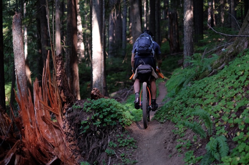
Notes: This route was a lot harder than I expected. There's 20 or 30 miles of singletrack once you climb away from Lookout Point Lake, and much of it involved pushing the bike uphill.

Day Two

Route: West Fir to Paradise
Distance: 62.1 miles
Elevation Gain: 4,219 feet
Surface: Almost all paved except for a few miles at the end on the McKenzie River Trail.
Food and Water: There are several campgrounds along the way with water (and you're following rivers most of the way), but nowhere with food until you get to Highway 126.
Notes: The Aufderheide Highway is almost totally empty, but when cars are on it they tend to drive slow and give lots of room. We saw a handful of logging trucks.

Day Three

Route: Paradise to Big Lake
Distance: 26.6 miles
Elevation Gain: 3,827 feet
Surface: Slow-going singletrack on the McKenzie River Trail (several miles of hike a bike), then fast singletrack on the west side of Clear Lake, and then sandy gravel up toward the Santiam Wagon Trail.
Food and Water: The lodge at Clear Lake has a restaurant and snacks (Oreos, nuts, etc.). I don't remember seeing potable water along the McKenzie River Trail but you could filter out of the river.
Notes: We actually stopped a few miles west of Big Lake because it was getting dark, but there's a campground there with potable water.

Day Four

Route: Big Lake to Sisters
Distance: 25.1 miles
Elevation Gain: 1,511 feet
Surface: Sandy and unrideable (unless you had a fat bike, maybe) in the beginning, then better quality once you get to Forest Service Road 500. Finish on paved road (Highway 242) into Sisters.
Food and Water: Water in Big Lake and at Cold Creek Campground on Highway 242 near Sisters, and lots of food in Sisters.
Notes: A few miles east of Big Lake the Santiam Wagon Trail splits into three roads. The road to the far right/south (which is listed as the Santiam Wagon Road on maps) is unmaintained and unrideable and requires carrying bikes over rocks and trees. We opted for Forest Service Road 500, which is the middle road at the split. This takes you to the end of the Santiam Wagon Road and it's much nicer to ride on. We stayed in a backyard in Sisters, but there's a campground in town with showers spots for cyclists. We also heard (though did not confirm) that there is dispersed camping a few miles south of town on Three Creeks Lake Road.

Day Five

Route: Sisters to Sun River
Distance: 50.4 miles
Elevation Gain: 2,848 feet
Surface: Paved to Bend, then singletrack to Sun River.
Food and Water: There are plenty of options for food and water in Bend.
Notes: A really nice route, except for some mosquitos (if you stop long enough) along the Deschutes.


What I Packed

All together, my bike, gear, food, and water weighed about 40 pounds. I was mostly happy with the amount of stuff I packed and didn't find myself wanting for much of anything along the way.

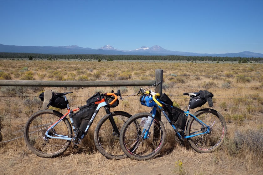
Here's a photo of everything packed onto the bike and a category by category breakdown of what went in:
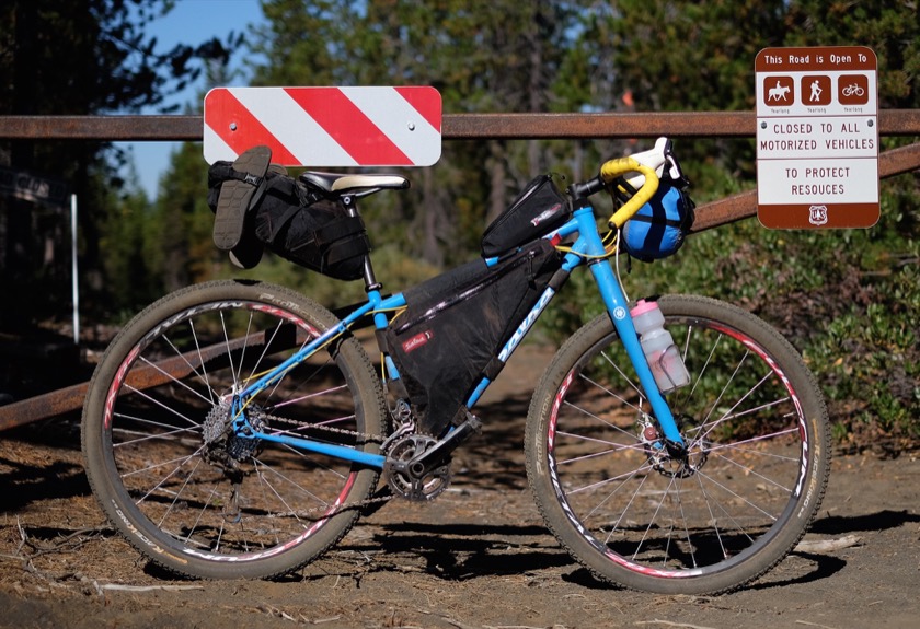
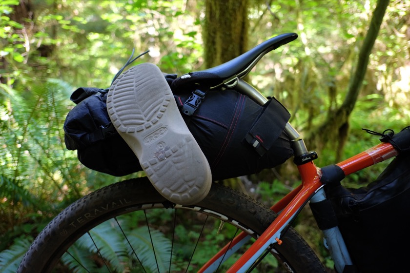
The seat bag held my sleeping bag, pillow, and clothes. The frame bag held my tent poles, food, and toiletries. The gas tank (the bag on top of the top tube behind the stem) held my raisins. The handlebar bag held my tent, tent fly, and sleeping pad. I also wore a backpack which held my camera, phone, wallet, an extra lens, and 60 ounces of water.

Camping

Tent with fly: An ultralight Big Agnes Fly Creek 1. Worked great.
Sleeping bag: My 40° down bag is getting old and cold, but I made up for it by wearing lots of clothes while I slept.
Sleeping pad: Required.
Pillow: Bought on a JetBlue flight. A luxury, but a very light, cheap luxury. Glad I brought it.
Utensils: Brought along a knife, spoon, and fork.
Bowl: For oatmeal and Ram-o-lami.
Sunscreen: Very valuable. Used about four ounces.
DEET: Didn't use at all but I'm glad I had it.
Headlamp: Only used this once when looking for a campsite north of West Fir in the dark, and it was invaluable.
First aid kit: Didn't use it, but prudent to have at least a small one on hand, especially in the event of a bike crash.
Chamois cream: Used Vaseline and DZ Nutz. Got a saddle sore, but that probably had more to do with my saddle choice than my creams.
Soap: Used soap leaves. Wish that I'd brought liquid Dr. Bronner's.
Bandanas: One of the most useful pieces of traveling kit there is. On my previous trip I had one for padding camera and one for bathing, but this time I made do with one. When bathing, use it as a washcloth first, then rinse, wring out, and use as a towel to dry off.
Lighter: Used for starting Ryan's alcohol stove each night and morning.

Bike

Bicycle: A newer Salsa Fargo on loan from one of Ryan's friends.
Bags: Revelate seat bag, frame bag, and gas tank. A prototype handlebar bag with stuff sack. And a no-name hydration backpack.
Bottles (2): I carried two 24 ounce water bottles (plus the 60 ounces in the backpack). This was enough with water stops along the way, but I wish we had a better water filtration setup (so that we didn't have to wait 4 hours for pills to work).
Multitool: Ryan and I shared one.
Patch kit: Make sure the glue is fresh.
Tubes (2): I think two is enough.
Pump: Ryan and I shared one.
Chain link: Didn't use it, but necessary if your chain breaks.
Lock: Coiled, so not too secure, but good enough in a pinch and not too heavy. Coiled is also easier for locking to odd objects like trees and picnic tables. Didn't actually use it this time (though I did on my previous trip), but I would've if I were traveling alone.

Clothing

Flip flops: My off-the-bike footwear. Not good enough for a hike, but light and disposable.
Prana yoga shorts: With the exception of my long underwear, these were my only off-the-bike bottoms.
Underwear: Ex-Officio for off-the-bike.
Long underwear: Kept me warm at night and around the campsite.
Knee warmers: I only wore these at night when it got really cold.
Long-sleeved capilene shirt: Recommended by Gordy, ended up being a critical piece of clothing. Wore during the day, to sleep, and sometimes as an undershirt when riding on colder days. Smelled awful.
Socks: One pair was enough.
Cycling shoes: Clipless.
Bib shorts: I think an extra pair might've been worth the weight.
Jersey: Only took one so that my tan lines would be uniform. Smelled terrible, but that doesn't matter when you're on the bike.
Undershirts: Could've gotten away with one.
Sunglasses: Cheap plastic pair from Performance Bike.

Toiletries

Contacts: I wore these during the day.
Contact solution: Small travel bottle.
Contact container: Self-explanatory.
Eye drops: Hours on the road in the sun can do a number on my eyes so I brought eye drops, but I ended up not using them.
Glasses: Only used these a few times at night, but they're good to have in an emergency.
Toothbrush: Self-explanatory.
Toothpaste: Brought a small travel-sized tube.
Floss: Whenever I eat lots of jerky I have to be extra diligent about flossing.
Advil: Didn't use but nice to have on hand.
Steroid cream: For eczema.
Imodium: Didn't need, thank goodness.
Earplugs: Makes it much easier to sleep in crowded (and even empty) campgrounds.
Tweezers: Sent home, but then I got a sliver. Probably worth the weight.
Hand sanitizer: Only used a few times but nice when using campground pit toilets.
Toilet paper: Just in case.

Stuff

Maps: Brought along several maps to cover our route. They turned out to be very valuable. Also had Ryan's Garmin to navigate off of, which was critical for the first day of riding.
Fuji: My camera for the trip, an X-T1 with a wide-angle lens and standard lens.
Fuji charger: I didn't take a lot of pictures so only had to use this once or twice.
Nexus 5 smartphone: Thought about leaving this at home, but it ended up being incredibly useful. Phone to keep in touch with Rachael, Ride with GPS for navigating, and WordPress for blogging. Left in airplane mode most of the time to save battery.
Nexus charger: Barely used the phone so only had to charge it once.
Kindle: I thought I'd have a lot of free time but I ended up sleeping as often as I could.
Wallet: Self-explanatory.
Cash: I brought $300 and spent about half of it. Handy for paying at campgrounds and small mom and pops that don't accept credit cards.

Food

I completed my first summer cycling trip without a stove but Ryan wanted to bring one so we used his. I'm not sure that I'm converted to traveling with a stove, but it was really nice to wake up with hot oatmeal and coffee. Ram-o-lami in the evening was nice, too.

Tortillas: Don Pancho ten pack, went through two.
Peanut butter: One big chunky jar.
Honey: One bear's worth.
Raisins: Sugar.
Electrolyte pills: Ryan gave me a few of these.


How It Went

What went well

Routing: I'm glad we took the route we did, I just wish we knew a little more about what we were getting ourselves into (see below). The route is probably better ridden east to west, but it was still great the way we did it.

Food: The peanut butter honey tortilla comes through a winner again, though this time it was supplemented by hot coffee, hot oatmeal, and hot Ram-o-lami.

Pictures: One of the objectives of this trip was to take pictures that might be useful for Ryan's job (he works in the bike industry). I don't know yet if any of them will end up being helpful for him or his company, but it was still fun to have a mission.

Clothing: I didn't bring enough warm clothes for my first tour but I corrected that mistake this time around.

What didn't go well

Saddle Sores: I opted for a different saddle than the Cardiff I used on my first tour because the Cardiff was starting to give me a little numbness. I didn't have any numbness with my new saddle, but it did give me some saddle sores (even though I've ridden it for years). I guess I just didn't give myself enough time to adjust. In retrospect, I ought to have stuck with the saddle that I'd already ridden for nearly a thousand miles this summer, numbness be damned.

Planning: Ryan and I did a lot of research on the route before we departed, but apparently not enough. The first day of riding to West Fir had significantly more climbing and singletrack than we expected, resulting in a very long day. And the Santiam Wagon Trail was all but closed on the eastern end which meant we had to backtrack and then detour. I'd probably follow the same route to do it over again, but knowing what we were getting into would've made it less difficult.

Next time

On the first day of the trip, and for much of the second, I couldn't help but think that I'd exhausted my desire for bicycle trips and that this would be the last one I'd attempt. But by day three, those feelings had passed, and I'm looking forward to the next time that I'll be able to string together a few destinations into a point to point bicycle trip.

I enjoyed the off-road nature of this trip (compared to my first, where car traffic was a frequent concern and occasional nuisance), but I think I'll be sticking to road touring for a while. A few reasons: it's easier to plan, there are more resources along the way, and you can do it alone (I really enjoyed riding with Ryan, but I'm not sure if he'll always be available when I want to go on tour). Not to mention the fact that bikepacking requires a whole new set of gear. Most of what I used was generously loaned to me by Ryan and his friends.
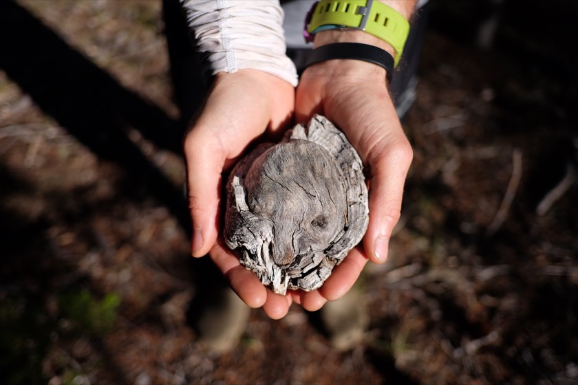
I don't know what these chunks of wood are called, but they sure look cool. Edit: They're called burls! Thanks, Rob.

The whole point of this post is to share the things I learned from my trip. If there's something you'd like to know about that I didn't cover, please leave a question below and I'll do my best to answer it.
Ryanegon Day Five: Sisters to Sun River

We were on Highway 20 for about a mile, just long enough to stop at the viewpoint and get a picture with Broken Top and the Three Sisters.

Distance: 50 miles (of 230 total)
Elevation Gain: 2,800 feet (of 19,500 total)

It got cold last night. Weather report says it got down to 43°. I wore long underwear, knee warmers, a long sleeve Capilene shirt, my cycling undershirt, and my socks. That was enough to keep me warm and comfortable. It was a morning like any other, except that we woke with lots of condensation on the tents and had to dry them in the sun before we left.

We bought a few delicious pastries for breakfast (ham and cheese croissants and an apple fritter) at Sisters Bakery and then headed out of town, opting for paved roads to Bend since we'd be singletrack to Sun River. It's possible to ride from Sisters to Bend on Forest Service Road 4606, but our host in Sisters recommended against it because of traffic and road quality.

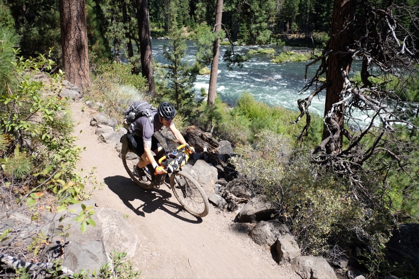
We spent the second half of the day on the Deschutes River Trail, which connects Bend to Sun River.

Ryan's on a repaired seatpost now so w'ere able to make good time. Went straight through Bend and onto the singletrack of the Deschutes River Trail, minus getting lost in Bend for a while. The trail was techincal in parts and required a little hike a bike, but the further south we went the more flowy and fast the trail became. We paused every few miles to take pictures, even braving a swarm of mosquitos that surely made Ryan, who's from Minnesota, think me a wimp.

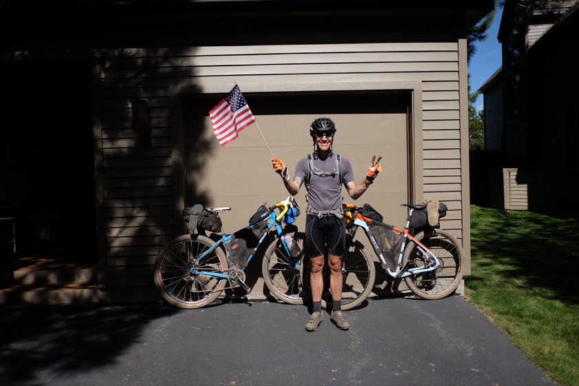
Our triumphant arrival in Sun River was thwarted by a wrong address, but when we finally got where we were going it was hard to deny a small sense of pride at what we'd done. Five days, 230 miles, and 19,500 feet of climbing, but most importantly we'd set ourselves to a goal and completed it.

I hugged and kissed Rachael, who I haven't seen nearly enough this summer, and she returned the favor by hosing the mud and dirt off of me with a garden house. It felt great.

We arrived at this house in Sun River and thought we were done with our journey, but it turns out that we had the wrong address.

This post is part of a series on my bikepacking trip from Eugene to Sun River. You can find my other posts here.

Ryanegon Day Four: Big Lake to Sisters

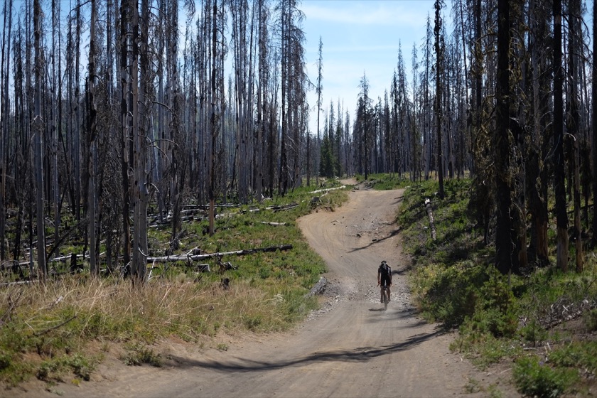
East of Big Lake our riding took us through land that burned in the B & B Complex Fire of 2003.

Distance: 25 miles (of 180 total)
Elevation Gain: 1,500 feet (of 16,700 total)

Slept well despite the cold and uneven ground. Finished our oatmeal and ate a muffin for breakfast. Had dreams of food last night which makes sense because we're running a bit low and I'm getting a bit hungry. Should've bought more peanut butter at our last store stop on the McKenzie River.

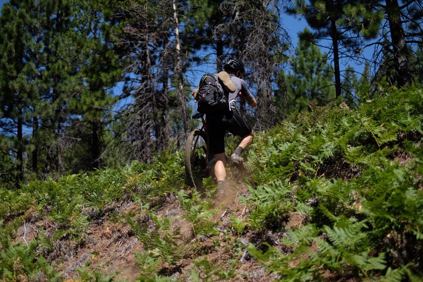
We started the day by hiking our bikes up the Santiam Wagon Trail because the sand was too soft to ride on.

Plenty of walking today though not having to pick the bike up as much as we had to on the McKenzie River Trail. We had been following the Santiam Wagon Road but a few miles east of Big Lake the road slowly degraded into nothing, blocked by big rocks and downed trees. This area burned in 2003 so maybe the Forest Service stopped maintaining the trail. Luckily there was a decent road a few hundred feet to the north (Forest Service Road 500) so we hiked through the brush and downed trees. Our pace was much improved after that, traveling on forest service roads east and then south down to Highway 242 (which I rode during my Aroundegon trip a few weeks ago).

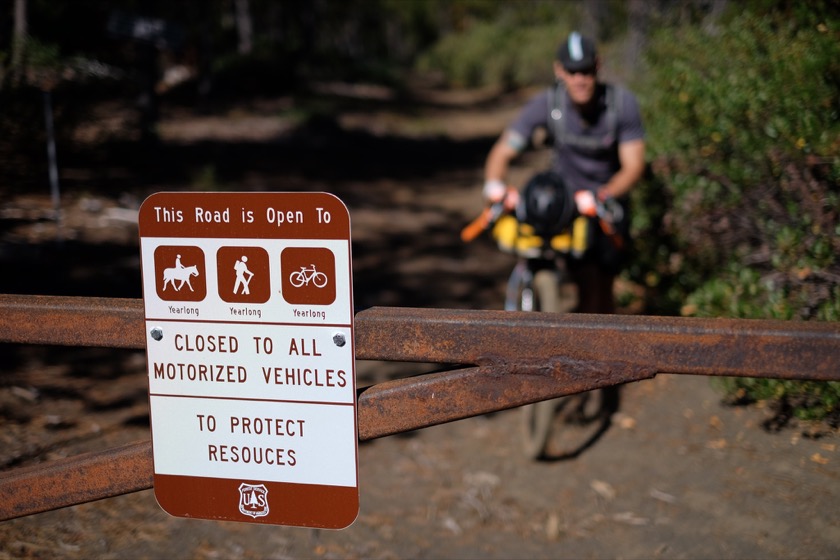
A few miles east of Big Lake the Santiam Wagon Road becomes unrideable, so we hiked up a hill to join Forest Service Road 500.

Stopped for a final peanut butter honey tortilla at Cold Spring Campground and then continued on to Sisters, where we enjoyed some good luck. We rolled into Blazin Saddles Bike Shop in Sisters to get a replacement seatpost for Ryan and ended up chatting up the owner, Casey, about our trip thus far and how we should get get to Sun River, our final destination. He ended up offering us his backyard for the night, so once Ryan's bike was put back together we stopped off for a donut and then headed to Casey's house to clean up.

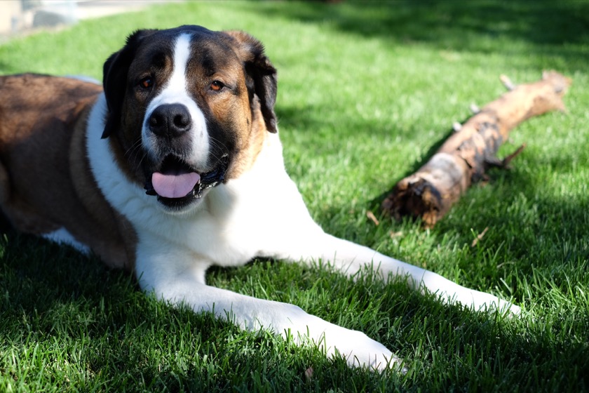
Our backyard companion in Sisters, a Saint Bernard named Cutty.

Dinner was veggie fajitas at a Mexican restaurant in town followed by ice cream at BJ's. After a few beers around a backyard fire with Casey and his girlfriend we turned in for the night. We'll ride to Sun River tomorrow.

This post is part of a series on my bikepacking trip from Eugene to Sun River. You can find my other posts here.

Ryanegon Day Three: Paradise to Big Lake

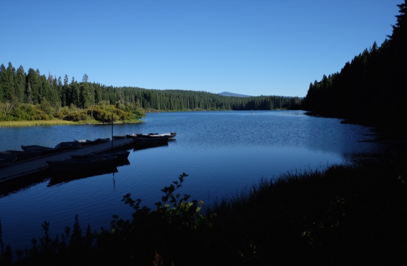
Clear Lake, one of the prettiest I've seen. We stopped here in the afternoon for a corn dog.

Distance: 27 miles (of 155 total)
Elevation Gain: 3,800 feet (of 15,200 total)

Leisurely start to the day after eleven hours of warm sleep (glad I brought long underwear!). Oatmeal and coffee for breakfast prepared over Ryan's alcohol stove, then packing up and on the road. Rode the first few miles on the highway to warm up in the sun and then cut into the singletrack of the McKenzie River Trail.

Needless to say, seatposts aren't supposed to have big cracks in them. This happened early in the day and was a major turning point for the trip.

Riding was going great, butt didn't hurt, high spirits all around, until Ryan's seatpost snapped. Transferred the gear it was carrying to my bike and Ryan's backpack and then evaluated a few poor options of what to do next. Didn't want to turn around in search of a bike shop, so Ryan decided that we ought to keep riding, even though it meant he'd have to stand up to do any significant peddling. There's a bike shop we'll be able to visit in Sisters but that's still a couple days away.

The McKenzie River Trail is exciting in parts but also way harder than I expected. People keep saying, "You're riding it up?" Most people ride it from Clear Lake downhill to McKenzie Bridge, but our route is taking us the opposite direction.

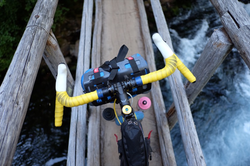
My cockpit crossing one of the McKenzie River Trail's many narrow bridges.

Ate two tasty corn dogs at the lodge at Clear Lake (which was smart because we ended up not having much food for dinner) and then returned to the forest in search of the Santiam Wagon Trail. Made it about a quarter mile up walking through the sand before finding a decently flat spot to make dinner (soupy instant fettuccine which made me miss last night's Ram-o-lami) and pitch tents. Can't help but think that people camped in this exact spot 150 year ago when passage was made by horse and wagon.

Feeling much better today than the first couple days. Butt isn't as sore, legs aren't as tired. Sucks that Ryan's seatpost is broken but he's still upbeat and appears to have no intention of letting it ruin his trip.

This post is part of a series on my bikepacking trip from Eugene to Sun River. You can find my other posts here.

Ryanegon Day Two: West Fir to Paradise

We rode the Aufderheide Highway (also known as Forest Service Road 19) from West Fir up to the McKenzie River. Nearly all of our riding today was on paved roads.

Distance: 66 miles (of 128 total)
Elevation Gain: 4,200 feet (of 11,400 total)

Woke up not robbed and not murdered, despite sleeping on the side of the highway, so it's a good start to the day. Spent a couple hours packing up and making breakfast (oatmeal and coffee) and then on the road.

My butt really hurt at the beginning of the day and then got progressively worse. Applied Vaseline a few times to prevent saddles sores, but it only helps so much. At least we were on smooth roads today, except for the McKenzie River Trail at the end, during which I couldn't sit down because of the rocks and roots.

Highlight of the day occurred on the climb out of the Willamette basin and into the McKenzie. Ryan was up the otherwise empty road a little bit when we spotted a big animal on the side of the road. Thought it was a cougar at first but a second look revealed a black bear looking right back at us, two or three hundred feet up the road. I didn't feel any immediate danger since the bear had noticed us and didn't appear startled. I don't think they're known to rush at people, but if it did we could've just turned around and ridden down the steep hill we'd been climbing.

The bear walked across the road and disappeared into the trees a few seconds later and left Ryan and I waiting to see if there were any others. Sure enough, a small cub, maybe a foot and a half at the shoulders, emerged from the trees on one side of the road and followed the mother to the other. "Good thing we didn't get between those two," I said. We were about to start riding again when another cub appeared. But instead of crossing like the other, this cub disappeared back into the trees from which it came.

Now we were really in a spot. Momma bear was on one side of the road and one of her cubs (maybe more) was on the other. We obviously weren't going to wait there all day, but to ride forward would mean breaking the cardinal rule of bear safety: don't get between a mom and her cub (I later learned that this applies to grizzly bears, not black bears). So we continued riding, constantly looking into the trees on the sides of the road until we were a few hundred feet past where we'd spotted the bears. We never saw them again.

Got into Paradise Campground with plenty of daylight left. Took a bath in the icy McKenzie (which really helped my butt) and then made some "Ram-o-lami" at the recommendation of Ryan's friend Andy. We had high hopes but it turned out to be not much more than ramen and meat, Tillamook beef jerky sticks in our case. Still, it was filling and tasty.

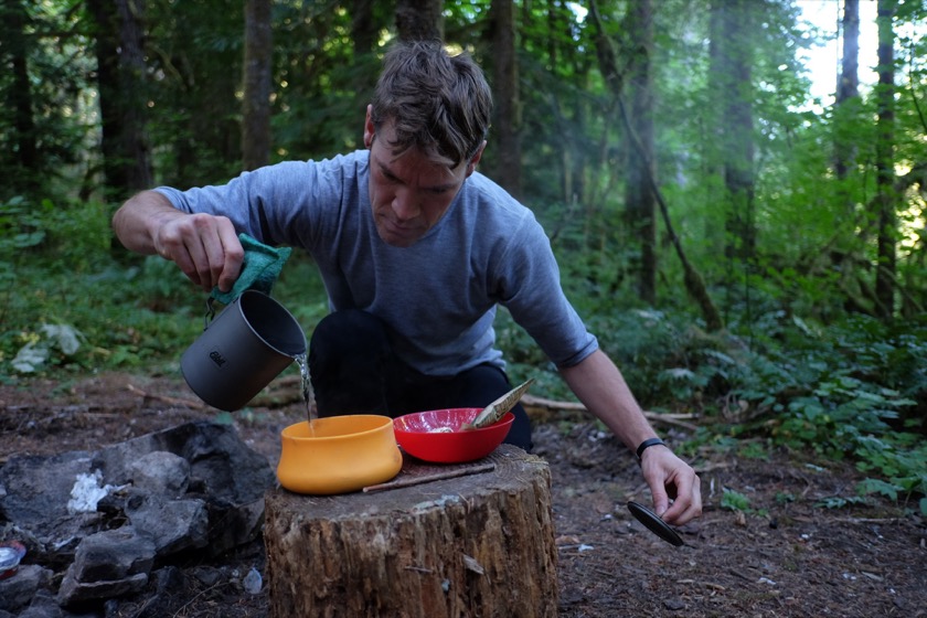
Ryan preparing oatmeal for breakfast.

In good spirits after bathing and eating though seriously unsure about how this is going to end up. If my undercarriage situation doesn't improve tomorrow I may have to take desperate measures.

This post is part of a series on my bikepacking trip from Eugene to Sun River. You can find my other posts here.

Ryanegon Day One: Eugene to West Fir

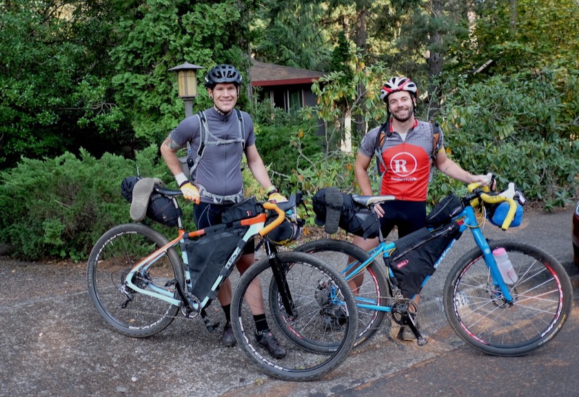
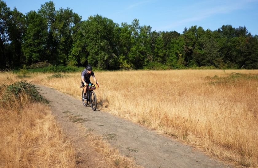
Ryan and me in Eugene on the morning of our departure. We're both riding off-road touring bikes, on loan from one of Ryan's friends.

Distance: 66 miles
Elevation Gain: 7,200 feet

Today was really, really hard. Much harder than even my hardest day on my first tour, though at least weather wasn't a factor. Ate breakfast and talked a bit with Eric (one of Rachael's cousins) and then said bye to Sarah (our host in Eugene) and headed out.

We were still moving fast and in high spirits as we rode through Elijah Bristow State Park, southeast of Eugene.

Some singletrack to start, then paved roads to Elijah Bristow State Park, singletrack, gravel, then hills. I'd hung with Ryan just fine until the hills started but then he slowly started to pull away.

After that we had to hike our bikes up a section of track that was too steep to ride and flanked by seas of poison oak, bringing flashbacks to all of the times I've been covered in its itchy oils. Hike a bike is exhausting. Eventually we were able to ride again, but the climbing (during which I'd fall far behind Ryan) and hiking weren't yet over.

There was way more singletrack than we expected, more bike pushing, more climbing. We underestimated how much water we'd need and ended up drinking (treated) water out of a stream. Hopefully we don't get giardiasis.

Other things started going south. My handlebars weren't dialed very well which lead to lack of control and some hand pain. And since I didn't pack nearly enough water I started to get really thirsty. Ryan and I found a stream to drink out of, but we had to wait awhile before drinking the treated water so I felt pretty dehydrated. I had no hope of keeping up with Ryan at this point, though thankfully he periodically waited up.

We made it to West Fir (just west of Oakridge), got a burger, scrubbed down with Tecnu, and then headed up the Aufderheide Highway as the sun was setting. By the time we found a decent spot it was completely dark out, but at least the day had come to a close. Hopefully tomorrow is better.

This post is part of a series on my bikepacking trip from Eugene to Sun River. You can find my other posts here.